
In one of my earliest books, Scandalizing the Ton, I set my heroine’s residence in London’s Mayfair, the area of London that borders on Hyde Park, and includes such Regency places such as Grosvenor Square, Gunter’s Tea Shop, St. George’s Church, Piccadilly, and Oxford Street, places very familiar to readers of Regency set historicals. I had my hero meeting her in the mews behind her town house.
Harelquin Historicals are edited by the UK branch of Harlequin whose offices are in London. As it so happened, one of the editors was walking through Mayfair back then and noticed that there weren’t any mews behind the houses on the street where my heroine lived. Luckily, I had time to change that part of the story.
I love telling that story. Imagine living in a place where you can in person check the historical accuracy of books set over 200 years ago. I love walking through Mayfair where so much is unchanged from that time period.
Needless to say, I try not to make mistakes like that again. But since I cannot walk through Mayfair myself, I must rely on maps.
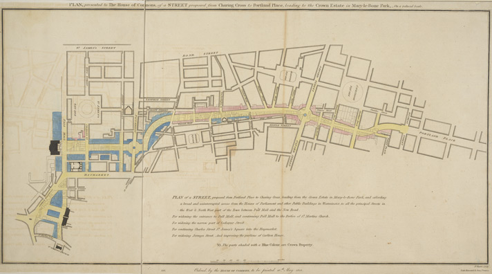
My current favorite map to use is the 1806 Mogg Pocket or Case Map of London. It is incredibly detailed and expandable.

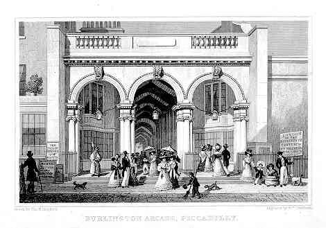
Using the map isn’t foolproof because Mayfair changes. For example, the Burlington Arcade was not built until 1818.
And Regent Street changed the area considerably.
So I still have to be careful….